THE EARTH IS ROUND
SO ARE KEYLINES
On P. A. Yeomans, water and the art of reading landscapes
This text is not a Keyline manual. It will not explain how to draw the right lines across a slope in a few simple steps. That is precisely where the misunderstanding often begins: with the hope that a landscape can be reduced to a method.
It begins with observations, journeys and encounters — above all in Spain. Places where water was pumped for kilometres while rainwater ran away unused. Landscapes whose history disappeared beneath the great catch-all phrase climate change. Erosion control carried out along the line of steepest descent. An Earthship built, of all places, in a natural drainage line. And a functioning water landscape that nearly had one more well-intentioned ‘Keyline measure’ imposed upon it.
P. A. Yeomans therefore appears here less as the inventor of a technique than as a teacher of a particular kind of attention. His true achievement was not the line itself. It was the recognition that water, soil and terrain form an order that can be read — provided we are willing to look for long enough.
The pages that follow are about Keypoints and Keylines, ponds, valleys and ridges. Above all, however, they are about a question that ought to precede every act of planning:
What is the place already telling us before we begin to impose our answers upon it?
Before directing water, we must first learn to watch it.
CONTENTS
1. The Flat Earth as a Manageable World
2. When the Place Is Already at Work
3. An Unreadable Book about a Readable Landscape
4. The Landscape Had Water
5. Water Scarcity Begins with Rain
6. The Connection Holds — Just Not Here
7. Land Creates Water - Water Creates Land
8. Erosion Control Along the Fall Line
9. The Keypoint: Where a Valley Changes Its Gesture
10. No Problem the Next Cloudburst Could Not Solve
11. The Keyline: From Point to Distribution
12. A Good Pond Sits High
13. Planning as a Learning Spiral
14. The Earth Is Round - So Is the Landscape
15. When the Keyline Disappears but the Name Remains
16. Sources and Lines of Evidence
1. THE FLAT EARTH AS A MANAGEABLE WORLD
The Earth is not flat.
This is one of the less adventurous statements one can make about our planet. It is neither original nor especially brave, yet it seems to become necessary again at regular intervals. Apparently, some truths are so thoroughly established that sooner or later they begin to look suspicious.
The idea of a flat Earth nevertheless possesses a certain aesthetic power. It should not be underestimated. A disc is easier to grasp than a sphere rotating while orbiting a sun that is itself part of a moving galaxy.
A disc lies still. It has a top and a bottom, a centre and an edge. One can draw maps, establish borders, place an ice wall around the rim and stretch a dome above it. The world does not become any more accurate, but it does become easier to survey.
Perhaps that is part of its attraction.
The flat Earth is less a geographical theory than a psychological offer. It promises a world that submits to immediate appearances. Look out across the horizon and no curvature is visible. Therefore, the logic goes, the Earth must be flat. Personal perception becomes the final court of appeal:
What cannot be seen directly is dismissed as a construction.
What requires explanation is suspect.
What is complex smells of deception.
Historically, the matter is more complicated than the popular story suggests. The notion that all educated Europeans in the Middle Ages believed in a flat Earth is itself a myth. The spherical shape of the Earth was already well understood in antiquity. More than two thousand years ago, Eratosthenes calculated the Earth’s circumference with remarkable accuracy by relating shadows, the angle of the sun and distance. He did not need to see the Earth from space. He needed only to observe, compare and think.
That may be the most beautiful part of the story: the curvature of the Earth was not discovered because someone travelled far enough away to see it as a sphere. It was understood because someone took two places, two shadows and a relationship seriously. The Earth became round long before it was photographed — not in the eye, but in thought.
The modern Flat Earth movement is therefore not simply the remnant of an ancient worldview, but a curious mixture of mistrust, simplification and anti-modernism. It lives on the promise that the world can once again become immediately comprehensible. One need only look for oneself, test for oneself, doubt for oneself. Yet this is precisely where the irony lies: vision narrows rather than widens. The world is permitted to be no larger than the method used to control it.
Flat Earth theory is not merely wrong. That would almost be too little. It is wrong in an unusually instructive way. It reveals how powerful the desire for a simple world can be. It shows how easily observation is confused with understanding. It shows how a reality that is curved, moving, layered and only indirectly perceptible can be reduced to a surface as soon as we accept only what conforms to the immediate view.
What is truly interesting about the flat Earth is therefore not the shape of the planet. That question is settled. What matters is the shape of the thinking.
A flat world needs no relationships in depth. It needs no invisible connections, no delays in time, no interactions between places, forces and processes. It knows surfaces, lines and edges. But it does not know landscape.
For landscape is never flat, not even where it appears to be. It consists of gradients, stores, pathways, delays, layers, soils, roots, evaporation, wind, shade, runoff, infiltration and time. Water does not move across a map, but through a body. It follows differences in elevation, soil pores, compaction, vegetation, ditches, tracks, old decisions and new mistakes. It does not simply disappear. It is held, accelerated, distributed, lost, stored or made destructive.
A landscape regarded only as a surface can be surveyed, owned, divided into plots, driven across and administered. But it will scarcely be understood. One may see the slope but not the path of the water; the soil but not its capacity to absorb; drought but not the rain that previously ran away unused; erosion but not the decision that prepared it. One sees a line and calls it a method.
Perhaps that is why the flat Earth is a useful place to begin a text about Keyline. Not because Keyline has anything to do with Flat Earth theory, but because the two show, in opposite ways, what happens when people try to read a landscape. One makes the world simpler so that it fits the existing picture. The other requires the picture to expand until it does justice to the world.
The flat Earth is wrong — but it is easy to survey.
Landscape is seldom easy to survey — but it is right.
2. WHEN THE PLACE IS ALREADY AT WORK
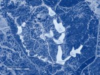
In Extremadura lies a property that, over the years that followed, became an impressive example of decentralised water retention. Sepp Holzer had designed and created a landscape of lakes and ponds in which water was not removed from the land, but held high, distributed, stored and brought to life.
This was not an abstract measure. Its effects could be seen.
The existing dehesa structure of old holm oaks responded more visibly with each passing year. The trees became healthier, denser and more luxuriant. The landscape did not suddenly appear ‘finished’, but it had begun to respond to the altered movement of water. Hardly any water still left the property. What would previously have been lost now remained in the system for longer.
A group of young Spanish farmers managed parts of the dehesa extensively and somewhat intermittently. They were friendly, likeable, committed and clearly influenced by permaculture. They were not enemies of the landscape, technocrats or industrial simplifiers. Quite the opposite: they plainly wanted to do something good.
That is precisely what made the following idea so interesting.
During one visit, they explained that they wanted to add ‘Keyline structures’ to parts of the property. What they meant, however, were not Keylines in Yeomans’s sense, but infiltration ditches running roughly along the contour. That equation was problematic in itself. More important still, however, was another fact: water retention was not the unresolved problem at this place.
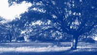
The landscape was already at work.
Water was being held. The dehesa was recovering. The holm oaks were responding. The place was not saying: a method is urgently missing here. It was saying: an intervention has begun to take effect.
Additional ditches would therefore not simply have meant ‘even more water retention’. They might also have damaged the roots of old holm oaks, opened the soil, disturbed existing water movements and unsettled a functioning system. An ecological measure does not become right merely because it is additional. Sometimes the next good measure is not another measure, but observation.
Yet this objection was difficult to convey.
‘Keyline’ sounded right. ‘Keyline’ sounded like permaculture. And if permaculture was good, Keyline had to be good as well. The term had moved in front of the place.
The genuinely permacultural question here would not have been: what further method can be applied? It would have been: what is the landscape already doing? Where is it improving? Where does it need support? Where does it need time? And where, above all, does it need not to be disturbed by a good idea?
The crucial question would therefore have been: how can a resilient agricultural use be developed from the existing combination of old dehesa structures and new water retention?
This is a decisive point. Planning with nature does not consist in laying as many correct methods as possible over a place. It consists in recognising which action makes sense from within that place — and which does not.
A method is not right because it carries the right name. It is right when it fits the situation.
Keyline therefore does not begin where someone says ‘Keyline’. It begins where someone has understood the place.
3. AN UNREADABLE BOOK ABOUT A READABLE LANDSCAPE
After this scene, P. A. Yeomans becomes interesting.
Not as the supplier of a slogan. Not as the inventor of a pattern. But as someone who tried to take water, soil and topography seriously enough for a different kind of agricultural planning to emerge.
Yeomans’s book Water for Every Farm is not an easy book. It does not read like a set of instructions that can be opened, skimmed and carved into a landscape the following weekend. It is not a recipe book, not a methods manual in the contemporary sense, not a collection of catchy principles with attractive diagrams for seminar rooms. It is closer to an attempt to watch a landscape think.
That is exactly where its difficulty lies.
Yeomans is not difficult because he failed to understand the landscape. He is difficult because he may have understood too much of it at once. His experience, creativity, acuity and extraordinary understanding of water and terrain are so multilayered that language can barely keep pace.
For him, water is never merely water. It is runoff, erosion, storage, distribution, soil formation, plant growth, labour, risk, capital, fertility and future.
A valley is never merely a valley. It is a collecting space, a gradient, a form, a history, a possibility. A line is never merely a line. It is the visible outcome of a relationship that was previously invisible.
Reading Yeomans can feel like standing with him at a front door. He puts the key into the lock and begins to turn it — then, in the next moment, pulls it out again, runs three times around the block and sits on a bench to feed the pigeons. One is left briefly bewildered. Later it becomes clear: perhaps he did not want to explain the door. Perhaps he wanted to show how the whole neighbourhood works.
It is demanding. But that is also why the book remains so interesting. It resists quick exploitation. It cannot easily be turned into a slogan without doing violence to it. Which is precisely why it has so often been turned into slogans since.
‘Keyline’ sounds wonderfully simple. A line. A key. A method. It can be shown in lectures, drawn on plans, explained in courses, followed with machinery and accompanied by the comforting feeling that something profound has now been understood. Yet the first danger already lies there. Keyline does not begin with a line. Keyline begins with a landscape.
Yeomans did not think from the surface outwards. He thought from the water outwards. And water does not think in property boundaries, parcels, ownership or pleasing patterns. Water reads gradient, finds weaknesses and accelerates wherever acceleration is possible. It infiltrates where soil, roots and pores permit it. It destroys where a landscape has been opened, compacted, stripped bare or wrongly directed. It seems to disappear, only to return as drought, erosion, crop loss, groundwater decline or flooding.
To understand Keyline, one must first understand that Yeomans did not invent a line, but a way of reading landscape. The line is merely the moment at which that reading becomes visible.
In its abbreviated form, Keyline is often reduced to this: draw lines roughly parallel to the contours across a slope, loosen the soil, distribute water, build humus. Under certain conditions, that can be useful. It can also miss the place entirely. A line drawn without understanding the valley, gradient, soils, vegetation, existing water paths and actual runoff dynamics is not a Keyline. At best, it is a declaration of good intentions with a strong reputation.
Yeomans’s real concern was broader.
He did not ask: how can an attractive pattern be placed on a slope?
He asked: how can an agricultural landscape be organised so that water does not disappear as quickly as possible, but remains productive for as long as possible? How can rain be slowed, distributed, stored and translated into soil fertility where it falls? How can a farm use its topography not as an obstacle, but as hydrological intelligence?
In this respect, Yeomans stands at odds with much of modern land use. Modern agriculture has often treated landscapes as troublesome surfaces: too wet, too dry, too uneven, too small-scale, too slow. They were drained, straightened, cleared, dug, ploughed, levelled, enlarged and accelerated.
Water became a problem when there was too much of it and a shortage when there was too little. Between the two lay surprisingly little thought about how much water a landscape might actually hold if it were not systematically prevented from doing so.
Perhaps that is where Yeomans becomes important again for contemporary landscape planning. Not because his methods must be copied unchanged. Not because every property needs a Keyline. Not because every slope should be covered with lines. But because he demands a different basic attitude:
Read first. Act afterwards.
In this sense, Keyline is not a geometry of the surface, but a grammar of landscape in space and time.
Anyone who takes the line without understanding the grammar has not acquired understanding, but an ornament.

4. THE LANDSCAPE HAD WATER
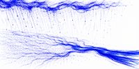
On another delegation visit with Josef A. Holzer, we went to a public agricultural research institution in Spain. Its director, a young and self-assured manager, spoke openly about the growing difficulties: heat, drought, climate change and water scarcity. Increasing quantities of water had to be pumped to the site from far away, through a pipeline roughly ten kilometres long.
At first, it sounded like a familiar story. A region becoming drier. A research institution in need of water. A technical answer to a growing problem.
Then the landscape began to contradict it.
The site contained several thousand square metres of roof. Gutters or visible systems for collecting that water were scarcely to be seen. Large sealed surfaces discharged rainfall as though rain were an operational accident. Deep erosion gullies appeared beside technical areas. Along the edges of the plantations lay ditches, damaged retention structures, torn-open gabions and traces of water that had by no means passed harmlessly across the site.
The obvious question was whether heavy surface runoff occurred there during rainfall events.
The answer was no.
That was probably not a lie. Perhaps it had simply never been seen. Perhaps no one was outside when it rained. Perhaps water was experienced there chiefly as a shortage, not as an event. Perhaps observation began only once the water was already gone.
The landscape, at any rate, said something different.
The ditches, damaged structures, sealed surfaces, absent roof-water harvesting and traces of erosion were not opinions. They were records. Water had written here — not in figures, reports or climate diagrams, but in channels, scours, deposits and broken edges.
The most obvious first step would have been remarkably simple: collect water where it already fell — on roofs, on technical surfaces, at those points where rain was not allowed to form landscape but was discharged as a problem. No grand theory would have been required. Only gutters, storage, open eyes and a willingness to believe the landscape.
The manager saw: we do not have enough water.
The landscape showed: you lose water when it is here.
The real problem begins in precisely that difference. Water scarcity then becomes not only a question of climate, but a question of perception. Anyone who sees water only once it is missing sees too late. Anyone who complains of drought without observing rain is reading only the final chapter of a story that began much earlier.
Perhaps this is the simplest form of landscape blindness: living in a water-scarce region, carrying out research, pumping water for kilometres — and overlooking the fact that one’s own site provides an answer whenever it rains.
The landscape had water.
It simply was not allowed to keep it.
5. WATER SCARCITY BEGINS WITH RAIN
Water scarcity does not always begin where it becomes visible.
It appears in summer: in wilted leaves, dry wells, dusty soils, falling groundwater levels and landscapes that no longer breathe but merely endure. We then speak of drought, aridity, climate change, insufficient rainfall and the need for irrigation. None of this is wrong. But it often begins the story too late.
For drought is frequently more than a condition of shortage. It is also the outcome of a history.
Water scarcity often begins with rain.
That sounds paradoxical, because rain initially appears to be the opposite of scarcity. It arrives as relief, abundance, an answer. Yet much is decided in that very moment: does the water remain? Is it slowed? Can it infiltrate? Does it encounter covered, rooted, absorbent soil — or compaction, bare ground, asphalt, roofs, channels, ditches and fall lines that carry it out of the landscape as quickly as possible?
A landscape can receive rain and still lose water. It can experience precipitation and become drier at the same time, because each rainfall leaves the system too quickly, carries soil with it, deepens runoff channels and weakens the land’s capacity to absorb the next rain. Rain then ceases to be capital and becomes a deficit on the balance sheet.
Drought appears later. It is caused earlier.
It resembles hunger in winter. Someone who goes hungry in winter experiences the shortage in winter. But its origins may lie in summer and autumn, in missed periods of abundance when nothing was gathered, stored or preserved. Winter is then not the cause of hunger, but the moment at which the mistake becomes visible.
Water often behaves in much the same way. The dry season reveals the shortage. The rain prepared it — not because it failed to fall, but because it was not allowed to remain.
The landscape had water. It simply was not allowed to keep it.
This shift changes the way we look. The question is no longer only how much rain falls, but what happens to it when it reaches the ground. We ask not only about irrigation, but about storage; not only about wells, but about soil; not only about climate, but about how the landscape behaves.
This is not to diminish climate change. Quite the opposite. Precisely because rainfall is becoming less regular, summers hotter, cloudbursts more intense and dry periods longer, the treatment of rain becomes more important. A landscape that handles water badly may conceal the consequences for a long time in a temperate climate. Under climate stress, it can no longer do so.
Climate change is becoming ever less forgiving of poor water retention.
This is where Yeomans’s relevance begins. He did not treat rain as a mere weather event, but as a test of how a landscape is organised. Rain reveals whether soil is alive, whether gradient has been understood, whether water paths are slowed or accelerated, whether storage lies in the right places, whether vegetation participates, and whether a farm uses its topography or works against it.
Rain is not weather. Rain is an inspection report.
Not written in words, but in traces.
Water retention is therefore more than holding water back. It is a cultural practice operating across space and time. It translates brief wet moments into longer dry periods: rain becomes soil moisture; soil moisture becomes plants; plants become shade; shade becomes cooling; living soil improves infiltration; improved infiltration reduces runoff; reduced runoff means less erosion; less erosion means more soil; more soil means greater water storage; greater water storage creates more habitat.
Land creates water. Water creates land.
Not in the crude sense that land produces water like a machine, but in the landscape sense: the shape, cover, rooting and vitality of a landscape help determine whether water remains, circulates, cools, evaporates, infiltrates and is stored — or vanishes again as a brief, brown and destructive visitor.
The essential statement remains simple:
Before a landscape complains of water scarcity, we should know what it does with water when water is present.
The flat explanation says: too little rain falls.
The deeper question is: what happens to the rain that does fall?
6. THE CONNECTION HOLDS — JUST NOT HERE
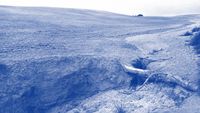
During the same journey, I spoke with a young scientist who had written her doctoral thesis in Madrid on traditional Spanish agroforestry systems. We discussed dehesas, those park-like cultural landscapes composed of holm oaks, pasture, animals, shade, fodder, fruit, timber and enduring soil fertility.
It was a compelling conversation: rich in knowledge, historical depth and a broad understanding of a system that is neither untouched wilderness nor industrial agriculture, but a relationship between trees, animals, people, farming, soil and water that has grown over centuries, perhaps millennia.
Spain was not always the extensively deforested, heated and water-scarce landscape it appears to be in many places today. The story often attributed to Strabo — that a squirrel could once have travelled from the Pyrenees to Gibraltar through the tree canopy without touching the ground — is probably more legend than reliable historical description. Yet the image remains powerful. It reminds us that landscapes have not only a climate, but a history.
Nor have the dehesas disappeared. Depending on the definition, they still cover millions of hectares of the Iberian Peninsula. Yet many of Spain’s traditional tree-and-crop systems have declined dramatically, some by more than ninety per cent. The old knowledge has not simply vanished, but it is under pressure: altered, reduced, economically thinned out or stripped of its landscape function.
It was therefore natural to ask whether deforestation, the decline of traditional agroforestry systems, increasing warming, water scarcity and altered rainfall might be connected.
The scientist answered cautiously. She did not know, she said, but would discuss the question with her professor in Madrid.
Several months later, the answer came.
The professor could confirm in principle that there were connections between forest cover and rainfall. In the present situation in Spain, however, this did not apply. Climate change alone was responsible there.
That is a remarkable statement.
Not because climate change plays no part. Of course it does. But because a broadly accepted landscape relationship is suspended at precisely the point where it would have to become uncomfortably concrete.
Forest cover can influence rainfall — but not here.
Vegetation can stabilise water cycles — but not now.
Land use can help shape climate locally and regionally — but not in this case.
The connection holds in general, but not in the place where one happens to be standing.
Climate change thus becomes an oddly exculpatory explanation. It is large enough to explain everything and distant enough to obscure the specific history of the landscape. The problem then arrives from outside: from the atmosphere, the global balance sheet, the great curve. It remains serious, but abstract.
The landscape itself no longer has to say anything.
Yet that is exactly what would be required. Climate does not fall upon neutral surfaces. It encounters soils, forests, plantations, pastures, towns, drains, open slopes, sealed ground and centuries of decisions. A landscape is not only a victim of climate. It is also an active participant in the water cycle.
Anyone who ignores this is not wrong in the broadest sense, but thinks too superficially. A real global process is laid like a sheet over a specific place. Beneath it disappear deforestation, soil loss, evaporation, shade, storage capacity, vegetation structure, and the question of what this landscape once could do — and can no longer do.
Perhaps this is the academic version of the flat Earth: not the denial of science, but the flattening of its application.
The connections are known.
But they are not allowed to land.
.

7. LAND CREATES WATER - WATER CREATES LAND
At first, these statements sound contradictory.
Land does not, of course, create water in the chemical sense. Nor does water manufacture land like a factory. Landscapes do, however, help determine whether water remains present; whether it circulates, cools, evaporates, infiltrates and returns as soil moisture, a spring, dew, mist, a plant or shade. Balanced soil moisture is a foundation of life — and therefore of soil formation.
Water does not fall upon a neutral world. It falls upon surfaces that respond to it in profoundly different ways.
A forest is not an arable field. Covered soil is not bare soil. A shaded hollow is not a sealed surface. A rooted slope is not a cultivated slope. Living soil is not compacted soil.
Each of these forms helps decide whether rain lingers or escapes.
A vegetated landscape has roughness. It slows wind and water, shades the soil, lowers surface temperatures, feeds soil life, creates pores, holds fine material, promotes infiltration, stores moisture and releases it gradually. Evaporation is not simply a loss. In living systems it forms part of a cooling and circulation process. Plants transpire water and transform solar energy into life processes, shade, growth and local cooling.
A stripped, compacted and overheated landscape does the opposite. It absorbs less water, loses more through rapid runoff, heats more strongly, forms crusts, weakens soil life, accelerates erosion and dries out more deeply. The rain may still fall from the same cloud, but it no longer falls upon the same landscape.
That is the point.
Climate is not only sky. It is also surface.
Anyone who looks only at CO₂, average temperatures and rainfall totals sees important things, but not everything. The great curve may be visible, yet the decisive questions remain unasked: why do two neighbouring fields react completely differently to the same rain? Why does one absorb water while the other produces mud? Why does one slope remain green while another forms a crust? Why does a group of trees create a different microclimate from an open field? Why does one landscape remember water for longer than another?
Yeomans and Holzer meet at precisely these questions. Neither regards landscape as a passive recipient of weather, but as a co-creator of water conditions. The difference is one of language, not of substance.
Water creates land because it forms soil, cuts valleys, deposits sediment, nourishes plants, enables microclimates and organises life.
Land creates water because it determines whether water can remain within the landscape or disappears as a brief, brown and destructive visitor.
Water retention thus becomes more than a technical measure. It becomes a cultural question.
How does a society treat rain? As a nuisance? Waste? A danger? A resource? A formative force? A living part of the landscape?
The answer is written not only in laws, funding programmes or strategies, but in ditches, soils, trees, roads, roofs, plantations, settlements, terraces and valleys. A landscape is an archive of its water decisions.
When it rains, that archive is opened.
8. EROSION CONTROL ALONG THE FALL LINE
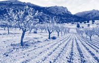
In many Spanish plantations, the soil is cultivated regularly, sometimes several times a year. Whether beneath olives, almonds or citrus trees, the ground is often left open, bare, freshly loosened and apparently well kept. To the eye it looks orderly. To water, it is often an invitation.
Bare soil is not neutral. It is unprotected. It heats more quickly, loses moisture, forms crusts more readily, offers less resistance to flowing water and has few roots to hold it. On slopes, this becomes a simple physical problem: when rain comes, water finds routes. And where those routes have been prepared, it takes them.
The situation becomes especially absurd where cultivation follows the fall line.
In conversation, we were told that cultivating the soil prevented erosion and improved water uptake. The furrows created across the slope, it was said, slowed the water. When attention was drawn to fields where cultivation clearly ran straight downhill, however, an astonishingly plausible answer followed:
On steeper slopes, machinery simply could not be driven across the contour.
That more or less said everything.
The measure is justified in terms of water retention, but carried out according to the constraints of the machine. Where it should slow water, it directs it. Where it should spread water, it concentrates it. Where it should protect soil, it opens it. Erosion control becomes runoff architecture.
This is not a minor technical inaccuracy.
It is a mistake in thinking with a gradient attached.
If a measure can be carried out correctly only where it is less urgently needed, and is carried out wrongly precisely where its rationale matters most, it should no longer be called a method. The machine, not the landscape, has made the decision.
The consequences are visible. After rainfall, roads and infrastructure are repeatedly covered in mud. Agricultural land develops erosion gullies, sometimes so deep and wide that they no longer look like incidental damage, but like a second road network made by water. On a flight to Seville in February, the Mediterranean appeared brown while we were still far from the coast. The landscape had lost soil — and the sea was reading the report.
The point is not to ridicule individual farmers. They act within habits, machinery systems, labour constraints, subsidy structures and inherited ideas of what ‘well-kept’ soil should look like. Yet that is precisely the problem. A practice can become so familiar that its consequences are no longer perceived as a contradiction.
Bare soil is regarded as order.
The machine is regarded as possibility.
The mud is regarded as weather.
Water sees things differently.
It does not follow the stated purpose of a measure, but its direction. It does not ask whether cultivation was intended to prevent erosion. It tests whether it slows or accelerates. Along the fall line, that test is rarely kind.
Perhaps this is one of Yeomans’s most sober lessons:
A line is not good merely because it has been drawn.
It is good when it corresponds to the water logic of the place.
Everything else is painting by numbers on a slope.
9. THE KEYPOINT: WHERE A VALLEY CHANGES ITS GESTURE
It is now time to address the actual core of Keyline. Not the slogan, not the lines on plans, and not the simplifications that came later, but the point at which Yeomans’s thinking becomes precise.
The Keypoint is not a mystical key location in the landscape. Nor is it a poetic spot from which one ought to gaze into the distance in a state of special emotion. It is a geometric and topographic concept.
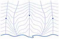
It can be understood as the point of transition in the longitudinal profile of a primary valley. With some caution, it may also be described as a turning point in the valley form — not its highest point, but the transition at which the valley changes shape and, with it, the work performed by water.
Above this point, the valley is generally steeper, narrower and more strongly convergent. Water gains speed there. It cuts, loosens soil, carries material away, deepens channels and shapes the slope through erosion. Below the Keypoint, the valley becomes flatter and broader. The energy changes. Water can more readily be slowed, spread, deposited and retained in the landscape.
The Keypoint is therefore the point at which a valley changes its gesture.
That sounds simple, but it is decisive. Yeomans does not begin with the question: where shall we draw a line? He begins with the question: where does the landscape show that its water logic is changing?
Here, water changes its work.
Above, collection and cutting tend to dominate.
Below, the possibility of distribution and storage begins. Not absolutely, not mechanically and not independently of geology, soil, vegetation and use — but as the basic movement of the form.
That is precisely why the Keypoint matters. It is not an arbitrary point in the terrain, but the transition between two hydrological behaviours. Anyone who finds it has not merely found a location. They have understood how this valley works.
And anyone who does not understand it will not understand the Keyline either.
No Keyline without a Keypoint.
No Keypoint without an understanding of the valley.
No understanding of the valley without an understanding of water.
The Keypoint, however, rarely stands in the landscape like a signpost. It must be read from the form of the valley, the gradient, indications of moisture, vegetation, traces of erosion, deposits, soil colour, old water paths and the behaviour of the terrain in rain. Contours can help. Maps can help. Digital terrain models can help. But they do not replace looking at the place itself.
This is where it becomes clear why Keyline is not a flat method. On a map one sees lines. In the landscape one sees relationships. A contour marks equal elevation. The Keypoint marks change. Understanding a landscape often begins not merely by recognising what remains the same, but where something shifts.
For Yeomans, the point also had practical importance because favourable opportunities for water storage and distribution can often occur nearby. Not as a miracle rule. Not as a guarantee. Not independently of subsoil, geology or previous interventions. But as a serious indication: where valley form, gradient and water behaviour change, there is often a promising starting point for storage ponds, spillways, distribution systems and cultivation lines.
That was Yeomans’s acuity: he did not seek the most spectacular intervention, but the most effective point.
A good water store is not simply a hole containing water. It is a decision in the topography. If it lies high enough, water can later work by gravity. If it is placed correctly, the landscape works with it. If badly positioned, technology must replace what the landform could already have provided.
The Keypoint is therefore less a point on a plan than a question addressed to the place:
Where does water begin to behave differently?
Anyone who takes that question seriously stops thinking in decorative measures and begins to read landscape as process. The Keyline arises from precisely that reading — not as an idea laid over the slope, but as a line emerging from an understanding of the point.
10. NO PROBLEM THE NEXT CLOUDBURST COULD NOT SOLVE
In Almería, one of Europe’s driest regions, another consultation with Josef A. Holzer took us to a property containing a so-called Earthship. Such buildings carry a particular aura in ecological circles.
They promise self-sufficiency, thermal mass, a close relationship with the earth and a way of life beyond conventional construction. They look like the future, like resistance to waste, like architecture made from discarded materials, and are intended to embody terms such as ‘recycling’, ‘upcycling’ and ‘downcycling’. In short, they are considered ‘sustainable’, ‘trendy’ and ‘hip’.
In the actual landscape, matters looked less clear-cut.
Old tyres, plastic sheeting and technical improvisations did not appear there as poetic reuse, but as foreign bodies in a sparse and sensitive environment. What was presented as ecological construction could also be read differently: as the introduction of problematic materials into a largely natural landscape.
It was no longer possible to establish who had actually profited from the old tyres. One thing was certain: a disposal problem had been relabelled as an ecological building material.
The owners told us that construction had once had to stop because the building site was flooded. Thereafter, scarcely any rain had fallen for several years.
That sentence alone should have been enough to make us listen carefully.
A site that floods during a rainfall event in an exceptionally dry region is telling us something essential. Drought does not mean that water plays no part. In dry landscapes, water is often absent for long periods — and then suddenly arrives with considerable force.
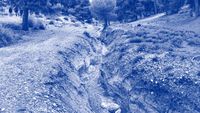
A closer look at the terrain showed that the building stood in a natural drainage line. Not at the edge of the water movement, but in its midst. A large catchment lay above it. The place was therefore not simply dry. It was dry between potentially powerful events. We appeared to be in the vicinity of a possible Keypoint.
After the consultation we stopped at a traditional tapas bar. Every beer came with a small local dish. We had rarely been so well fed by the end of an evening.
The situation became still more peculiar when viewed with Yeomans in mind. The Earthship did not stand in just any ditch. It stood precisely where a steeper watercourse entered a flatter area — in the section where water changes its work. In Keyline terms, exactly where one might begin to look for a Keypoint.
That is significant. A Keypoint is not a suitable place in which to put a house in the path of water. It is a place where one should understand how water can be collected, slowed, stored or redistributed. One does not build carelessly into it. One listens to the water first.
The building did not need to stand on the Keypoint. A more intelligent position would have been outside the direct drainage line — on a suitable Keyline, in relationship to the Keypoint but not in its belly. From there, water could have been directed with little effort towards the house, nearby gardens, trees and small stores. Homes, gardens and people need water. That does not mean the house itself should stand where water resumes its ancient work during an intense storm.
The absurdity here becomes almost architectural. A building can call itself an Earthship, speak of earth, claim self-sufficiency and celebrate recycling, yet still overlook the simplest question the place asks: where does the water flow?
Ecological symbolism is no substitute for understanding a site. An alternative building material is no substitute for reading the terrain. A subcultural narrative is no substitute for hydrology.
Water does not care whether a building was ecologically intended. It tests not the intention, but the position. It asks not for the name, but for the gradient, catchment, drainage line and resistance. And when that test arrives, it does not arrive as a discussion.
It arrives with the rain.
Perhaps that was the real point of the place: the house was called an Earthship. The next cloudburst would reveal whether a rudder and a helm ought perhaps to have been standard equipment after all.
11. THE KEYLINE: FROM POINT TO DISTRIBUTION
Curiously, this Earthship scene may explain more clearly than any diagram what a Keyline is — and what it is not.
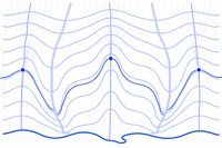
The Keyline is not the place where water can be ignored. Nor is it a line with which to decorate a slope. It is a geometric response to a relationship that has been read. First comes the Keypoint. Then the valley. Then the adjoining ridges. Only from these does the Keyline emerge.
To begin with, it is a particular contour: the line that passes through the Keypoint of a specific valley. Its frame of reference is not the entire property, the whole farm or the entire landscape, but this particular valley space. It runs from one adjoining ridge to the other. From ridge to ridge. It does not continue arbitrarily as a pattern across every landform.
That sounds technical. But it is crucial.
The Keyline is not merely a line. It is the optimal distribution line for that valley space. It shows where water can be spread through the landscape with the least effort and the greatest effect.
In many hilly landscapes, moisture collects in the valley while the neighbouring ridges dry more quickly. The valley receives too much water and the ridges too little. The usual movement of water reinforces the difference: water converges, accelerates, concentrates, cuts more deeply and often leaves the landscape precisely where it is needed.
Yeomans’s insight was as simple as it was ingenious: if the right line is found, this behaviour can be reversed — not by force, but by geometry.
The Keyline becomes the reference from which cultivation, soil loosening, ditches, terraces or other structures can be aligned so that water is no longer concentrated in the valley, but moves gently towards the drier ridges.
Above the Keyline, structures run parallel to it can have precisely this effect: they carry water from the wetter valley area towards the adjoining, drier ridges.
That is the real magic — and it is not magic at all.
It is topography, not enchantment. A precise understanding of landform, not esotericism. The line works because it was not invented against the gradient, but accounts for the actual curvature of the valley.
Below the Keyline, matters become more delicate. There, cultivation conceived merely as parallel can produce the opposite effect. Instead of distributing water from the wetter valley towards the drier ridges, it can carry water from the ridges back into the valleys. This is precisely why Keyline does not simply mean ‘working parallel to the contours’. Anyone who follows parallel lines without understanding their position in relation to the Keypoint can use apparently correct geometry to do the wrong thing.
This is one of Yeomans’s most important lessons: the same idea can distribute water above the Keyline — and collect it again below the Keyline.
A line is not good because it sits attractively in the terrain. It is good when it creates the right effect in the right place.
This also explains why a landscape does not have one single Keyline. There can be many Keylines because there are many valleys, hollows, ridges, changes in gradient and water logics. Each primary valley can have its own Keypoint. In larger landscapes, these points occur at different elevations, in different catchments and with different functions.
The Keypoint shows where water changes its work.
The Keyline shows where that change can become distribution.
The system emerges when many such points are understood from the top down.
Yeomans did not think in isolated measures. He thought from the first water to the later water, from the high storage pond to the lower one, from the small valley to the whole farm. The landscape already provides the basic structure through its ridges, valleys, gradients, collection areas and natural storage positions.
A good Keyline system is therefore not imposed upon the landscape. It is read out of it.
Many Keypoints together form a kind of hydrological score. They indicate where water can be held, spread, transferred or stored. From them, an interconnected system can emerge: storage in sensible places, spillways in the right direction, distribution lines at suitable elevations and cultivation lines that allow water to work across the land rather than accelerating it.
The aim is not to create as many lines as possible. It is to make use of as much landscape intelligence as possible with the least intervention.
That is why the Earthship would not merely have been ‘slightly better’ in a different position. It could have stood in relationship to the Keypoint rather than in its way. On the Keyline, outside the direct drainage line, it could have used water without exposing itself to it. From there, water could have been directed with little effort towards the house, nearby gardens, trees and small stores. The difference is small on a plan — and immense in the next storm.
Understood in this way, Keyline is neither a permaculture ornament nor a contour-following form of ecological reassurance. It is an attempt to take the existing geometry of water seriously.
The Keyline is the distribution line.
A line can be drawn.
A system has to be read.
12. A GOOD POND SITS HIGH
A water store is never merely a surface of water.
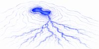
It is a decision about where water is allowed to gain time in a landscape. If it lies low, it may collect a great deal of water, but often only after that water has already rushed through the land. If it lies high, it can act earlier. Water is then not caught only at the end of a problem, but held at the beginning of a possibility.
A good pond sits high.
This does not mean digging ponds on every hilltop. It means storing water where it can achieve the greatest effect with the least effort. Water held high in the landscape possesses something no pump can replace: gravitational potential. It can later be distributed by gravity, supply lower areas, moisten soils, influence microclimates, stabilise vegetation and feed further stores.
A low-lying store is often a collection basin.
A high store can be a beginning.
Here Yeomans and Sepp Holzer meet, although they speak very different languages. Yeomans developed a topographic, almost engineering grammar of Keypoints, Keylines, storage ponds, spillways, gradients and soil development. Holzer reads landscape in a more agricultural, immediate and experiential way: springs, subsurface flow, hollows, terraces, warmth, stones, animals, plants, wind, shade, frost and sun. One describes the system more explicitly. The other works more directly from the encounter with the place.
Yet both understand something that modern planning often forgets: water is not merely infrastructure. Water forms landscape.
In this sense, a pond is not a decorative wildlife feature, a compensation area or an ecological accessory. It is part of a metabolism. It changes moisture, temperature, evaporation, vegetation, animal life, soil processes and human use. It can calm water before it becomes destructive. It can moderate drought before drought becomes visible. It can turn a brief rainfall event into a long landscape effect.
But only if it is in the right place.
A badly placed pond may remain beautiful. It may even contain water. But it works beside the landscape rather than with it. It then requires inlets, sealing, pumps, corrections, maintenance and explanations. A well-placed pond, by contrast, appears almost self-evident. It occupies a position where water has already asked a question.
Yeomans searched for such places systematically. Holzer often finds them through experience, observation and an almost physical understanding of slope, soil and water. In both cases, the aim is not to hold water somewhere, but to hold it where its effect is greatest and the intervention smallest.
That is a quiet but radical distinction.
Modern technology often asks: how do we bring water to where we need it?
Landscape thinking asks first: where does water already want to go — and how can we alter that movement so that it strengthens life rather than carrying soil away?
A good pond is therefore not a technical answer to water scarcity. It is a topographic answer to rain. It belongs not at the end of a pipe, but within a sequence of relationships: catchment, inflow, overflow, valley, ridge, soil, vegetation and use. It is a node in a living system.
Here too, the landscape already contains clues: water paths, moisture indicators, slope forms, old channels, spring horizons, compaction, deposits and changes in vegetation. They need not be romanticised. They need to be read.
Perhaps this is the strongest connection between Yeomans and Holzer: both take the landscape more seriously than the plan. Both know that water is not stored merely because someone draws a pond. It is stored when form, position, soil and use work together.
A pond is good when it does more than remain full.
It must be part of a landscape.
13. PLANNING AS A LEARNING SPIRAL
Planning with nature does not begin with a solution.
It begins with attention.
That sounds modest, but is more demanding than it appears. Attention does not mean visiting a place once, taking a few photographs, looking at contour lines and then drawing a concept. It means treating the place as a counterpart that does not reveal everything at once.
A landscape reveals itself in layers: differently in sunshine and rain, in winter and summer, after drought and after a cloudburst, before an intervention and after it.
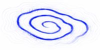
Good planning is therefore not a linear path from analysis to solution. It is a learning spiral:
observe, understand, interpret, act, reflect — and then observe again.
Not because nothing is known the first time, but because every intervention creates new information. A measure is never only an implementation. It is also a test. A pond reveals how water really arrives. A planting shows where the soil can support life and where it cannot. A swale shows whether water remains or disappears. A road reveals during the first rain whether it has become an access route or a drainage channel.
The landscape responds.
Anyone who plans seriously must be prepared to hear that response — even when it contradicts the plan.
This is what distinguishes living planning from faith in methods.
Faith in methods says: this measure is right because it belongs to the right system.
Living planning asks: what is happening here, in this place, under these conditions, with this soil, this water, this use and this history?
It is less convenient. But it is more truthful.
In this sense, a plan is not an order issued to the landscape. It is an invitation to a conversation. A hypothesis is proposed: if we hold water here, cover the soil there, reroute this road, stop leaving that field bare, then the place may respond differently. Thereafter, the plan is not the sole judge. Reality also decides.
This attitude protects against two errors.
The first is passivity: doing nothing because everything is complex.
The second is activism: doing something simply because a method is available.
The real field of work lies between the two. Action occurs there, but not blindly. Intervention occurs, but not as a final word. Planning occurs, but in a way that allows the place to continue speaking.
In this sense, Yeomans was not a supplier of finished patterns, but a teacher of directed attention. Holzer is the same in a different way. Both show that landscape is not understood by reducing it to a scheme. It is understood by taking its responses seriously.
This may be the deepest connection to Keyline: the line is not the beginning of planning. It is a condensed answer to observation. And after the line, observation begins again.
For a landscape is never completely explained.
It remains movement.
It remains relationship.
It remains resistance to thoughts that are too simple.
Perhaps that is precisely the difference between flat planning and living planning:
Flat planning wants to be finished.
Living planning wants to remain capable of learning.
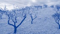
14. THE EARTH IS ROUND - SO IS THE LANDSCAPE
In the end, this is not about Flat Earth theory, and not only about Keyline.
The flat Earth was the starting point because it makes visible a way of thinking that reduces reality to a simple surface. A disc is manageable. It has edges, lines, an above and a below. It can be drawn, explained and controlled. It offers little resistance, provided one does not look too closely.
Landscape is different.
It is not a surface, but a body. Not an image, but a process. Not scenery, but a counterpart.
It consists of gradient, soil, roots, water, shade, wind, use, history and time. It is full of relationships that remain invisible if one looks only at the surface.
Perhaps this is Yeomans’s real lesson: a landscape does not become comprehensible by being simplified. It becomes comprehensible by being observed more precisely.
Keyline is therefore not a trick. It is not a line placed across a slope because it sounds good, not a permaculture decoration and not a technical magic formula against drought. Keyline is an attempt to take the geometry of water in the landscape seriously.
The Keypoint shows where water changes its work.
The Keyline shows how that change becomes legible within the valley space.
The system shows how many such points can together organise a landscape.
But none of this begins with drawing.
It begins with seeing.
Not the quick seeing of first impressions, but the slower seeing that recognises relationships: where rain falls; where it runs; where it remains; where it carries soil away; where it builds soil; where the landscape is already working; where a good idea might cause harm; where a machine explains the slope — and where the slope refutes the machine.
That is the difference between a method and understanding.
A method can be learned, repeated, sold, certified, printed on plans and packaged into courses. Understanding is less convenient. It requires allowing the place to speak. It requires knowing not only what could be done, but also recognising when it would be better to do nothing.
This may be especially important in an age of ecological slogans. Almost everything now sounds regenerative, resilient, sustainable, nature-based, permacultural or climate-ready.
The problem is not that these terms are worthless. The problem begins when they become stronger than the place.
Then Keyline becomes a pattern.
Permaculture becomes a label.
Water retention becomes a construction programme.
Climate change becomes an explanation that says everything and obscures some things.
Ecological building becomes a story that no longer asks where the water flows.
The landscape remains unimpressed.
It does not respond to terminology. It responds to form, position, soil, vegetation, compaction, intervention and time.
It does not test whether a measure was well intended, but whether it works. That test seldom comes as a debate. It comes as rain, drought, erosion, mud, vitality, shade, a spring, a crack, a scour, root growth or the absence of life.
The landscape has its own grammar.
Anyone who wishes to read it must be willing to be corrected by it.
This may be the deepest difference from the flat world. The flat world wants to be right. The living landscape compels us to keep learning. It turns planning from a finished product into a relationship. Observation becomes understanding.
Understanding becomes action.
Action becomes response.
Response becomes new understanding.
The Earth is round. So are Keylines.
Not because they are circles, but because they do not arise from flat thinking. They belong to a world of relationships, transitions, feedbacks and time. Anyone who reduces them to a line loses exactly what makes them interesting.
What remains, in the end, is a simple demand:
Before the method comes the place.
Before the line comes the valley.
Before the pond comes the water.
Before action comes observation.
And after the action, everything begins again.


15. WHEN THE KEYLINE DISAPPEARS BUT THE NAME REMAINS
A later development is entitled to criticise what came before it. It may adapt methods to different climates, use modern surveying, account for machinery widths and take today’s requirements for hydraulic engineering and safety more seriously. It may even conclude that another system works better for a particular task.
But it should not have to diminish its predecessor in order to do so.
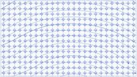
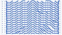
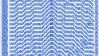
This is where Philipp Gerhardt’s public criticism of P. A. Yeomans’s original Keyline system becomes problematic. Gerhardt and the planning practice Baumfeldwirtschaft have developed a system of freely designed water-management lines, retention ditches and agroforestry strips. The lines are adapted to microtopography, runoff, storage volume, machinery widths and farming operations. That may make good technical sense. It is not, however, the same system Yeomans developed.
An article from Germany’s Federal Information Centre for Agriculture, in which Gerhardt explains the approach, goes considerably further. It states that the original Keyline Design is unsuitable for European landscapes and small-scale farming and is now rarely used by experienced planners. A few paragraphs later, the revised system is said to contain “no keylines any more”; instead, it uses freely designed water-management lines. Yet the overall approach continues to be called “Keyline Design”.
Baumfeldwirtschaft’s own website makes the break even more explicit. In its account of the Minga project in Switzerland, the classical Keyline structure is described as having been “entirely discarded”, and the “outdated Keypoint and Keyline structure” as superseded. At the same time, the site says that what is now understood as Keyline Design in German-speaking countries has little in common with the classical method.
This raises a simple question: if the Keyline has been discarded, why keep the name?
That would be little more than a terminological curiosity if Yeomans were being represented in full. He is not. His system was never the simple formula: find the Keypoint, draw the Keyline, then work an entire hillside blindly in parallel.
Yeomans distinguished between primary valleys and ridges, between Keylines and additional guidelines, and between cultivation patterns suited to different landforms. He explicitly warns against carrying a valley pattern indiscriminately across a ridge, because doing so can concentrate water in the wrong places. On ridges, the cultivation direction may need to be reversed. To turn this into a rigid pattern of parallel lines is to remove precisely the topographic discrimination Yeomans was trying to teach.
The conflation becomes even clearer in the discussion of cultivation. For Yeomans, Keyline cultivation did not mean turning over an entire hillside, still less constructing a network of permanent water-retention ditches. He favoured narrow-tined chisel-type implements; disc and mouldboard ploughs were explicitly not recommended for Keyline cultivation. The cultivation marks were intended to reduce the rapid concentration of rainfall in valleys, encourage lateral redistribution and improve infiltration. Yeomans described their effect as hundreds or thousands of tiny water-absorbing drainage paths.
Gerhardt’s present-day water-management lines are different. They are permanent, surveyed earthworks designed to intercept surface runoff, move it laterally, hold it, infiltrate it or discharge excess flows in a controlled manner. Structures of that kind need defined cross-sections, storage volumes, stable embankments and safe overflows. That is sound engineering. But a permanent retention ditch and a narrow Keyline cultivation pass belong to different categories.
To describe the hydraulic risks of a permanent ditch system and then attribute them to original Keyline ploughing is to compare unlike with unlike. Designing the ditch more precisely afterwards does not disprove Yeomans. It solves a different design problem.
The same problem arises with the “swales” supposedly promoted by Yeomans. In the searchable edition of Water for Every Farm used for this essay, the term swale does not occur. Yeomans certainly discusses dams, storage ponds, diversion channels and irrigation channels — but as distinct hydraulic elements with different functions. The swale as later popularised within permaculture should not be projected backwards onto Yeomans without evidence.
Gerhardt’s criticism therefore lands, in several important respects, on simplified imitations: poorly planned swales, mechanically copied lines and interventions labelled “Keyline” without first reading the topography. That criticism is necessary. But it is criticism of poor application, not necessarily of Yeomans.
Baumfeldwirtschaft’s water-management line system may nevertheless be a valuable development. Digital terrain models, hydraulic sizing, agroforestry strips, crossings and machinery-friendly working blocks address genuine problems on present-day farms. A good development does not need a simplified history in order to stand on its own.
What is harder to reconcile is declaring the original system unsuitable or outdated, removing the Keypoint and Keyline from one’s own method, and retaining the established name Keyline Design. It would be inappropriate to speculate about motives. The communicative and commercial effect, however, is plain: “Keyline Design” is an established term with history and recognition; “water-management line system” would be more precise, but far less familiar.
That is conceptually inconsistent. Anyone who strips a term of most of its defining content should either choose a new name or take particular care to represent its origin accurately and fairly.
Yeomans needs no halo. His books are difficult, some claims are products of their time, and Australian solutions cannot simply be transplanted to Europe. He can and should be criticised. But the target should be the system he actually developed, not a simplified version assembled decades later.
Perhaps that is the real irony: Gerhardt’s strongest criticism is directed at rigid rules, badly placed lines and methods that become more important than the place itself. A careful reading of Keyline warns against exactly the same things.
A later development may contradict Yeomans. It may extend his work and replace it in particular applications. But it should not first construct a simplified Yeomans, defeat that version, and then retain the name of his system.
You can dispense with the Keyline. What you cannot reasonably do is present its disappearance as the better Keyline.
16. SOURCES AND LINES OF EVIDENCE
This essay is not an academic paper in the narrow sense, but an essayistic text about planning, reading landscapes, water and Keyline. The following sources should therefore be understood as lines of evidence and points of orientation. The personal anecdotes are based on the author’s own observations, consultations and field visits in Spain between 2010 and 2015, undertaken with Josef A. Holzer or within the professional context of Holzer Permaculture. They are accounts drawn from advisory practice and landscape observation, not externally published case studies.
The author’s own consultancy and field observations
Kalkhof, Jens: Personal consultancy, field-trip and observational experience in Spain, particularly in Extremadura and Almería, between 2010 and 2015, within the professional context of Josef A. Holzer / Holzer Permaculture. Personal working notes and recollections form the basis of the essay’s anecdotes.
Holzer Permaculture Solutions: Technical consultancy for geology and forestry, focusing on water systems, soil health, biodiversity and resilient cultural landscapes.
https://holzerpermaculture.com/en/
Accessed 15 July 2026.
Krameterhof: Introduction Tour Holzer Permaculture, Josef Andreas Holzer.
https://krameterhof.at/en/guided-tours-and-workshops-at-krameterhof-farm/introduction-tour-holzer-permaculture/
Accessed 15 July 2026.
Flat Earth, Eratosthenes and the shape of thought
University of Texas / McDonald Observatory: Eratosthenes Measures Earth’s Circumference. An accessible account of the ancient calculation of the Earth’s circumference using shadow angles and distance.
https://outreach.as.utexas.edu/marykay/assignments/eratos1.html
Accessed 15 July 2026.
University of Delaware Research Magazine: First Person: Medieval Mythbusters. Corrects the popular myth that educated people in the Middle Ages generally believed the Earth to be flat.
https://www1.udel.edu/researchmagazine/issue/vol3_no1_humanities/first_person.html
Accessed 15 July 2026.
ABC / Great Moments in Science: The flat Earth was always a minority view. Historical context for Flat Earth beliefs.
https://www.abc.net.au/listen/programs/greatmomentsinscience/the-flat-earth-was-always-a-minority-view/11813566
Accessed 15 July 2026.
P. A. Yeomans, Keyline and Water for Every Farm
Keyline Designs: Historical and technical information about P. A. Yeomans, Keyline, Water for Every Farm, farm dams, Keyline cultivation and soil development.
https://www.keyline.com.au/
Accessed 15 July 2026.
Ag Water Stewards: Keyline Design. A concise introduction to the Keyline idea: holding water as high as possible and distributing it from wetter valley areas towards drier ridges.
https://agwaterstewards.org/practice/keyline-design/
Accessed 15 July 2026.
EcoFarming Daily: Keyline Design Changes the Way Farms Use Water. An accessible secondary introduction to Keyline design, Keypoints, water distribution and landscape planning.
https://ecofarmingdaily.com/build-soil/keyline-design-transforms-farm-water-management/
Accessed 15 July 2026.
Yeomans, P. A.: Water for Every Farm: Yeomans Keyline Plan. First published in 1954, with later revised editions. The principal primary source for Keypoints, Keylines, storage ponds, water distribution and landscape-based farm planning.
Note: Printed editions and reprints remain in circulation; wherever possible, a citable book edition should be used as the central primary source.
Online references accessed 15 July 2026.
Philipp Gerhardt, Baumfeldwirtschaft and water-management line systems
Federal Information Centre for Agriculture / Praxis-Agrar: Keyline Design – wirkungsvolles Werkzeug zur Klimaanpassung in der Landwirtschaft? [Keyline Design – an effective tool for climate adaptation in agriculture?]. Account of the revised approach explained by Philipp Gerhardt. Particularly relevant to Chapter 15 are the claims that the original Keyline Design is unsuitable in Europe, the abandonment of Keylines and Keypoints, and the continued use of the name “Keyline Design” for the revised overall system.
https://www.praxis-agrar.de/klima-und-umwelt/klimawandel/keyline-design
Accessed 21 September 2026.
Baumfeldwirtschaft / Deutsche Agroforst GmbH: Minga. The practice’s own account of the Swiss project; describes the classical Keyline structure as discarded and the Keypoint/Keyline structure as outdated, while the later development continues to be presented under the heading of “Keyline Design”.
https://baumfeldwirtschaft.de/projekte/minga/
Accessed 21 September 2026.
Baumfeldwirtschaft / Deutsche Agroforst GmbH: Wasser – Keyline Design [Water – Keyline Design]. The practice’s own description of its present system; it explicitly states that Baumfeldwirtschaft uses its own revised system, differing from original Keyline Design in line layout, implementation and maintenance.
https://baumfeldwirtschaft.de/wasser/
Accessed 21 September 2026.
Gerhardt, Philipp (2024): Agroforst und Keyline Design – Produktive Werkzeuge für den dezentralen Wasserrückhalt [Agroforestry and Keyline Design – productive tools for decentralised water retention]. Presentation at the Mittelfränkisches Wasserforum, Bavarian Environment Agency. Documents Baumfeldwirtschaft’s planning, surveying and implementation of agroforestry and “Keyline” water-management systems.
https://www.lfu.bayern.de/wasser/agws/doc/regionales/2_gerhardt.pdf
Accessed 21 September 2026.
Strabo, Iberia and the squirrel story
Strabo: Geography, Book III, Chapter 4, LacusCurtius / University of Chicago. An ancient description of Iberia, relevant as background to the often-repeated but source-critical story attributed to Strabo about a squirrel crossing Spain through the tree canopy.
https://penelope.uchicago.edu/Thayer/E/Roman/Texts/Strabo/3D%2A.html
Accessed 15 July 2026.
Wikisource: The Geography of Strabo / Book 3. Freely available translation, including descriptions of wooded areas of the Pyrenees on the Iberian side.
https://en.wikisource.org/wiki/The_Geography_of_Strabo/Book_3
Accessed 15 July 2026.
Note on use in the essay: the squirrel story should not be presented as a verified quotation from Tacitus or Strabo, but as ‘a probably legendary story often attributed to Strabo’. It is powerful as an image, but uncertain as historical evidence.
Dehesas, montados and traditional agroforestry systems
AGFORWARD: System report: Iberian Dehesas, Spain. Describes the dehesa as an agrosilvopastoral system and gives an estimated area of approximately 2.3 million hectares of dehesa in Spain and 0.7 million hectares of montado in Portugal.
https://www.agforward.eu/documents/WP2_ES_Dehesa_system_description.pdf
Accessed 15 July 2026.
IUCN: Dehesas & Montados. Overview of dehesas and montados, giving estimates — depending on the definition used — of around 4 million hectares in Spain and 1 million hectares in Portugal.
https://iucn.org/sites/default/files/2023-05/site_f.dehesas-montados_final.pdf
Accessed 15 July 2026.
Rangelands Atlas: An agrosilvopastoral system in southern Spain: the case of Dehesa. A concise account of the dehesa as a multifunctional agrosilvopastoral system.
https://www.rangelandsdata.org/atlas/case-studies/agrosilvopastoral-system-southern-spain-case-dehesa
Accessed 15 July 2026.
Eichhorn, M. P. et al. (2006): ‘Silvoarable Systems in Europe — Past, Present and Future Prospects’, Agroforestry Systems. An important source on the decline of traditional tree-and-crop systems in Spain: intercropped fruit-tree systems declined by 97 per cent between 1962 and 1999, and intercropped olive systems by 94 per cent.
https://treesinspace.com/wp-content/uploads/2015/12/eichhorn-paris-et-al-2006.pdf
Accessed 15 July 2026.
Smith, J. (2010): The History of Temperate Agroforestry. Organic Research Centre / Orgprints. A secondary source summarising, among other material, the decline of traditional Spanish tree-and-crop systems reported by Eichhorn et al.
https://orgprints.org/18173/1/History_of_agroforestry_v1.0.pdf
Accessed 15 July 2026.
AGFORWARD: Grazing and intercropping of plantation trees in Spain. On traditional agroforestry involving olive, almond and carob trees, and the decline or marginalisation of these systems.
https://www.agforward.eu/grazing-and-intercropping-of-plantation-trees-in-spain.html
Accessed 15 July 2026.
EURAF: Agroforestry in Spain. Overview of Spanish agroforestry systems, giving an estimated 5.6 million hectares of agroforestry and emphasising their importance in Spanish cultural landscapes.
https://euraf.net/2023/01/20/spain/
Accessed 15 July 2026.
Vegetation, forests, water and climate
Ellison, D. et al. (2017): ‘Trees, forests and water: Cool insights for a hot world’, Global Environmental Change. A major review of forest, water and energy flows, cooling, carbon storage and water distribution.
https://www.sciencedirect.com/science/article/pii/S0959378017300134
Accessed 15 July 2026.
Open-access PDF of Ellison et al. (2017):
https://eprints.whiterose.ac.uk/id/eprint/112170/1/1-s2.0-S0959378017300134-main.pdf
Accessed 15 July 2026.
Biodiversity for a Livable Climate: Summary of Ellison et al. (2017), Trees, forests and water: Cool insights for a hot world. An accessible secondary account of the central findings on forests, water and cooling.
https://bio4climate.org/article/trees-forests-and-water-cool-insights-for-a-hot-world-ellison-et-al-2017/
Accessed 15 July 2026.
Permanent ground cover, soil protection and erosion in olive groves
Márquez-García, F. et al. (2024): ‘Influence of cover crops and tillage on organic carbon loss in Mediterranean olive groves’, Soil & Tillage Research. Study of cover crops, runoff, erosion and carbon losses in olive groves; cover crops substantially reduced runoff and erosion.
https://www.sciencedirect.com/science/article/abs/pii/S0167198723002726
Accessed 15 July 2026.
Sastre, B. et al. (2016): ‘Soil loss in an olive grove in Central Spain under cover crops and tillage treatments, and farmer perceptions’, Journal of Soils and Sediments. Study of soil loss, cultivation and permanent cover in a central Spanish olive grove; cultivation produced unsustainable soil-loss rates, while permanent ground cover was highly effective.
https://inuouja.com/wp-content/uploads/2024/06/2-16.-Soil-loss-in-an-olive-grove-in-central-spain-under-cover-crops-and-tillage-treatments-and-farmer-perceptions-WEB.pdf
Accessed 15 July 2026.
Office International de l’Eau / ePlanete: Cover Crops and No-Tillage in an Olive Grove, Andalusia, Spain. Case study from an olive grove near Córdoba, indicating improved soil moisture, reduced erosion and greater biodiversity under cover crops and no-tillage management.
https://eplanete.oieau.fr/case-study/cover-crops-and-no-tillage-olive-grove-andalusia-spain?gid=15
Accessed 15 July 2026.
Almería, irrigation, water stress and groundwater
Caparrós-Martínez, J. L. et al. (2020): ‘Public policies for sustainability and water security: The case of the Almería horticultural model’, Sustainable Production and Consumption. Analysis of water availability, groundwater bodies, climate risks and policy frameworks within Almería’s intensive horticultural model.
https://www.sciencedirect.com/science/article/pii/S2351989420302250
Accessed 15 July 2026.
Aznar-Sánchez, J. A. et al. (2019): ‘Aquifer Sustainability and the Use of Desalinated Seawater for Greenhouse Irrigation in the Campo de Níjar, Southeast Spain’, International Journal of Environmental Research and Public Health. On aquifer overexploitation in Campo de Níjar and the role of intensive irrigated agriculture.
https://www.mdpi.com/1660-4601/16/5/898
Accessed 15 July 2026.
Junquera, V. et al. (2024): ‘Hydrological collapse in southern Spain under expanding irrigated agriculture: Meteorological, hydrological, and structural drought’. Study of water crisis, the expansion of irrigation and structural drought in southern Spain.
https://arxiv.org/abs/2408.00683
Accessed 15 July 2026.
Earthships, tyres and ecological building narratives
Earthship Biotecture: Building with Natural and Repurposed Materials. Official account of the use of tyres, cans, bottles and other repurposed materials in Earthship construction.
https://earthship.com/systems/garbage-management/
Accessed 15 July 2026.
Earthship Biotecture: Tire Retaining Walls. Official description of tyre retaining walls and rammed-earth tyres.
https://earthship.com/2020/03/27/tire-retaining-walls/
Accessed 15 July 2026.
Earthship Biotecture: Garbage Warrior. Presentation of the Earthship concept and the use of cans, bottles and earth-filled tyres.
https://earthship.com/garbage-warrior/
Accessed 15 July 2026.
Note on use in the essay: the Earthship passage should not claim that every Earthship is ecologically misguided or amounts to ‘hazardous waste’. A more defensible formulation is that old tyres, plastic sheeting and technical improvisations are not automatically ecologically harmless, and that ecological symbolism is no substitute for reading the terrain.
The following illustrations were created with the assistance of ChatGPT 5.6 within the ‘resonant space of resistance’: the opening image and the introductory illustrations for Chapters 1, 3, 5, 7, 9, 11, 12 and 13.
It should not be underestimated how strongly a dialogue with an AI can become such a resonant space of resistance — especially when the AI, too, has to learn, construct and correct itself.
The images, diagrams and photographs introducing Chapters 2, 4, 6, 8, 10 and 14, together with those preceding the sources, are the author’s own plans or photographs from field visits in Spain between 2010 and 2015.